
Ed Janiszewski for the Community History Project edjan@teksavvy.com
City Lane Number: #0402
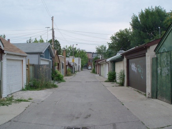
Described Location: First north/south lane east of Christie St. Runs between Dupont to Epworth Manse Lane.
 |
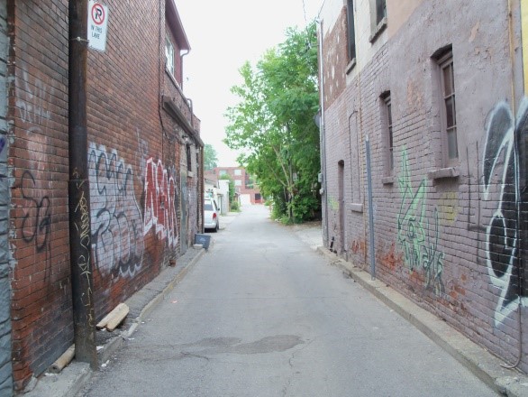 |
| Looking North from Epworth Manse Lane | Looking South from Dupont Street |
To commemorate the many transportation and transit vehicles that have been part of the intersection of Dupont Street and Christie Street.
The first public transportation to Seaton Village was begun on July 27 1885 with horse drawn cars running on tracks from Front and Frederik Streets along King, Spadina, College and Bathurst, but ended at Bloor, near the current Bathurst Subway Station. The eastern section of Seaton village was serviced by the Bathurst cars in 1889 when tracks were laid from Bloor to the CPR Railway north of Dupont St. the railway tracks initially created a barrier from continuing north. On April 19 1894 an electrically powered line was instituted on Bathurst between King St. and the CPR tracks. It wasn't until December 1906 when cars left from Dupont and Christie Streets along Dupont and Bathurst down to Front, Church and King. In 1908 the cars on Bathurst were called "Exhibition" and travelled from Dupont and Christie to the "Ex".
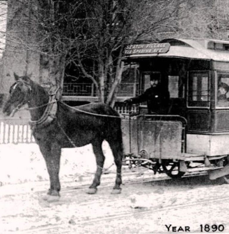
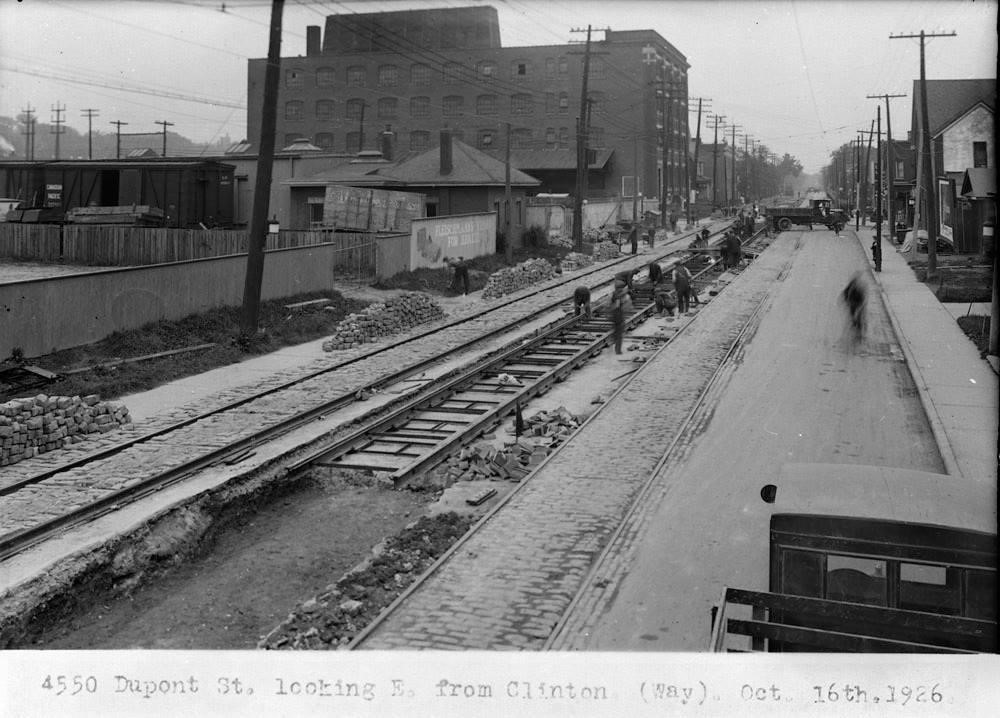
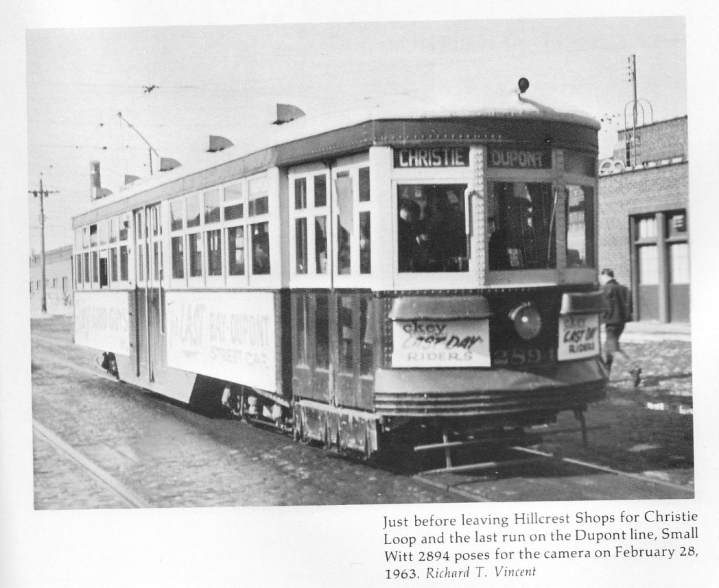
Toronto Street Railway Company, Horse Car # 42. The Seaton Village Trolley 1890s (on Spadina Road) The CPR railway serviced a diverse industrialization with spur lines along Dupont, including coal distribution depots, manufacturing, dairy product distribution, as well as the Ford Motor Sales building with a test driving track on its roof at the north-west corner of Christie and Dupont (later, Planter's Peanuts, and currently Faema Cafe and tech development and design businesses.) This necessitated improved transit for their workers. The Christie-Dupont intersection was the turnaround area, or wye, for Streetcars from about 1921 to 1963 (see the Peter Witt photo), then trolley buses on the Annette route looped there, later extended to the St. George Subway Station after the streetcar line was abandoned.
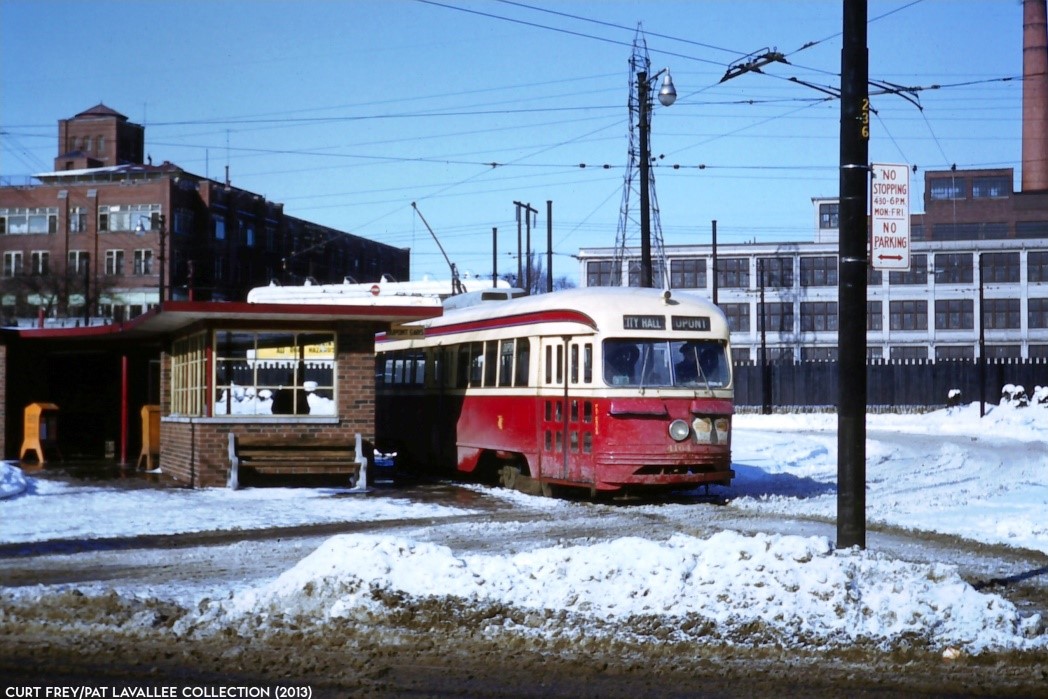 DUPONT cars terminated at Christie loop, where this shelter shielded passengers from the elements while they transferred to the ANNETTE trolley bus.
When the University Subway opened in 1963, the ANNETTE trolley bus was extended to St. George Station, and this loop was rendered surplus.
This photo, of air-electric PCC #4164 at Christie loop, taken before March 30, 1954, was donated from the Curt Frey collection.
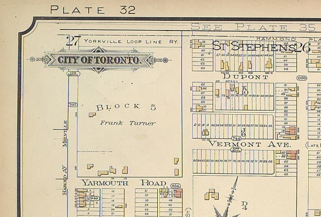
Another interesting rail history story is the establishment of the "Yorkville Loop Line Railway Company of Ontario" https://archive.org/stream/cihm_52163#page/n3/mode/2up. Goad's Maps of this area title the tracks just north of Dupont from 1890 (below) up until about 1903. The proposal document describes its creation and purpose as charted in 1873, intending to run from a point on the Grand Trunk Railway of Canada at or near the Carlton Station to a point, also on the Grand Trunk Railway, in the township of Scarborough, passing through the village of Yorkville." This line was meant to bypass the "crush" of rail traffic at the Esplanade by creating a through route for freight and passengers. It is unclear how successful this rail route was or whether it was taken over by another railway company.
The Witts; An Affectionate Look at Toronto's Original Red Rockets, by Larry Partridge, The Boston Mills Press, 1982.
See also: https://transit.toronto.on.ca/bus/routes/4-annette-1947-.shtml
https://www.taddlecreekmag.com/dupont-at-zenith
https://transit.toronto.on.ca/streetcar/4117.shtml